In the world are a few "lost cities" and one of them is in Morocco, in the desert. When I first read that in the desert it is a Portuguese fortress, I could not believe it and thought in the desert and the Portuguese? What would they do in the desert, moreover to build the fortress, when they are sailors and builds fortress only on the coast.
After searching of more information and coordination so I found that between Erg Chebbi and Erg Chigaga is really this fortress, built during the reign of Sebastião I of Portugal, probably around year 1562 and known as "A Cidade Perdida" "Lost City", or as Ba Ba Hallou and even Hasi Hallou. Many names it have.
We started in Taouz and went right towards a small hill Ouawfilalt, the road crossed the river without water of course and through very small, low sand dunes. It was flat there only and we approached Ouawfilalt where there were many camels grazing.
Then we came to Tadaout, a rocky mountain range where there are old paintings carved on stones. The mountain range was on our right side. It was wonderfully there, a plateau between two mountain ranges.
Then we came to the first salt lake, which was leftovers or the bottom of the ocean before. So big as it just glistened in our eyes.
We went through a small village Ouzina maybe. We had still about 22 km left to Ramlia as I saw on the sign on the road that led into an auberge there. But we never have gone through Ramlia, we had it from afar only.
Until now it was only sandy road, now changed it to an admittedly sandy but also a little harder stony surfaces. We approached Tijakht, mineral mines that appeared there in the mountain on our right side.
Then we drove along oasis Bourika, a wonderful place.
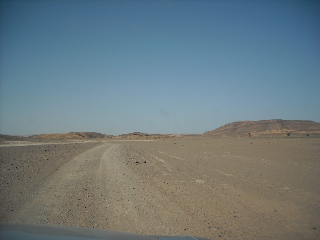
Suddenly piste just became rocky and gravel hamada who went over to the small dunes again. We saw one small camp there, with just a tent and toilet, the toilet was funny, like a tower it was. But it was empty there, just one camel outside. Maybe it was some inside the tent there, it was shade where they hid from the sun.
And suddenly it came, first one hill, and close in front of it was this fortress or ruins out of it. Wonderful to see it, what I was waiting all the time had appeared now. We parked the car and climbed up on the hill and became overwhelmed out of view from up there, as far as one could see, incredible, like moon landscape.
I understood that Portuguese had found a perfect place to monitor the entire area and nothing could escape them. On one side was the mountain range beyond, on the other side the river M'birika, so they were protected from all directions.
It was a little difficult to take pictures of the place, not so many pictures to show, my camera is quite simple.
Wonderful desert around with a smaller or larger sand dunes, mountains, rivers without water (at least at a time when I was there). Around grazing camel (but unfortunately not wild of course), goats, sheep, several smaller oases, of salty dried-up lakes, a remnant of the ocean, with the surface incredibly white. Mountains are rich in minerals and fossils, and there are remnants of old paintings engraved in the rocks.
After admiring both the fortress and the view I went down and we continued our journey now to look for any auberge where we could eat a little because we got to be hungry.
Trail went through the salt lakes again, narrow sand dunes and oases, Hamada, saw a camel caravan on the way somewhere, without tourists, just alone, does not even have a way camel man or he was hidden somewhere in the shadow because it was really hot.
Then we went to Ramlia, a small village there and continued to look for any auberge. Some were there but closed. Finally we found one, the owner and his son have just eaten so they have invited us to eat what was still there so it was really fun to sit there with them in the kitchen (bigger and finer than I have at home haha) and eat.
Driver was tired so he dozed a little. After to wake up he had going and prayed and then we continued our journey back. The car began to boil so we had to stay time to time on the road and the driver got to cool down the engine with water. And I was looking at donkeys, they are so fine animals.
We continued then through Ouzina and approached us Taouz where we came now from the other side so we really did a semicircle through the desert, it could be about 100 km. So we have gone from Taouz on the right side over qued Merhermine to the fort and back on other side via Remlia, Ouzina and came to Taouz.
It was one wonderful trip and I hope I can do it one or more times and go the whole way there until Erg Chigaga, but when, it is one other question of course.


